Further
Posted: January 19, 2014 Filed under: Newfoundland, Water | Tags: Atlantic Ocean, Canada, Department of Fisheries and Oceans, East Coast Trail, fisheries and oceans, libraries, library closures, Newfoundland, ocean, science librarian Leave a commentIn an earlier post I spoke about my concerns that the Canadian government is closing a series of libraries in the Department of Fisheries and Oceans. Since writing that post, I’ve come upon an article on the subject by John Dupuis, a science librarian at York University in Toronto. He speaks about the issues and questions arising from these closures. Here’s the link to his article: Question! What is really happening at the Department of Fisheries and Oceans libraries?.
And, in keeping with Fisheries and Oceans, here’s a photo of the Atlantic Ocean off Newfoundland from my time there in August.
Politics, Nature and the Censoring of Science in Canada
Posted: January 16, 2014 Filed under: Books, Canadian Rockies, Newfoundland, Water | Tags: Alberta, Canada, Canadian Conservative Party, Canadian government, censorship, Conservative Party, environmental science, environmental scientists, fisheries and oceans, nature, Newfoundland, oil, pipelines, politics, science, science libraries, scientists 2 CommentsScience: The systematic study of the nature and behaviour of the material and physical universe, based on observation, experiment, and measurement, and the formulation of laws to describe these facts in general terms. — Collins English Dictionary
I never go through a day without thinking, at some point, about the destruction of nature in the world and the efforts to halt that destruction and restore natural areas. You’ll likely have heard that the Canadian Conservative Party, who are in power now, sees oil extraction and pipeline building as priorities for the country’s prosperity. At the same time, they have fired publically employed environmental scientists, cancelled whole projects and prohibited public scientists from speaking about their findings without first being vetted so that they are “on message.”
Recently the government has closed a series of science libraries connected with the Department of Fisheries and Oceans. They say this is to consolidate information, digitize it and save money. Apparently, however, a government email has surfaced that speaks of culling the information and lists the savings as around $440,000. This may be a lot of money for most of us, but it is quite a low saving for a federal budget. In the last few weeks, researchers have discovered that materials from the closed libraries, some with records dating back a century, are being destroyed. A photograph showing books and papers in a dumpster has appeared online. I find this deeply troubling.
My own belief is that these destructive actions toward environmental scientists and scientific information speak to the Conservatives’ desire to withhold knowledge (inconvenient truths) of our eco systems from citizens. Not only can destroying knowledge have destructive consequences for our health and wellbeing in Canada and beyond, but it is deeply undemocratic.
I’m writing about this today to do my small part in spreading the word and to say there can be no justification, financial or otherwise, for destroying knowledge or for censoring the messengers. I’ve added a few links if you’re interested in reading further. Plus some photos of the beauty of nature in Canada.
http://thetyee.ca/News/2014/01/09/Harper-Science-Library-Closure/
English Harbour Encore
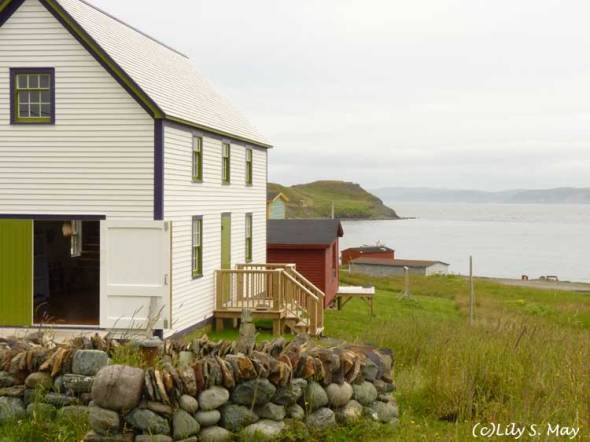
Posted: December 17, 2013 Filed under: Mineral World, Newfoundland, Water | Tags: arts, dry stone wall, English Harbour, English Harbour Arts Centre, Newfoundland, ocean Leave a commentHere’s two views of the English Harbour Arts Centre that we visited last August while in Newfoundland. It was wonderful seeing such positive human endeavours in this setting of beauty by the ocean. The stones you see in the foreground are part of a spiral dry stone wall, created during a workshop at the Centre.
English Harbour, Newfoundland
Posted: December 11, 2013 Filed under: Newfoundland, Water | Tags: Bonavista Peninsula, English Harbour, Newfoundland, ocean Leave a comment
Approaching English Harbour , August 2013
English Harbour is a tiny village in Newfoundland on the ocean. It’s on the Bonavista Peninsula not far from the town of Trinity. While driving toward Port Union this past August, I noticed a sign pointing to the English Harbour Arts Centre. I decided to turn off the main road to the village, which we found to be a lovely surprise and yet another very beautiful place. I’ll post some photos later of the Arts Centre itself, either on this blog or my art blog.
Boyd’s Cove Beothuk Site, Newfoundland
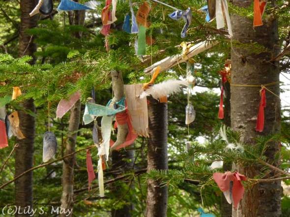
Posted: November 26, 2013 Filed under: Inspiration, Newfoundland | Tags: aboriginals, Beothuk, Beothuk village, Boyd's Cove, Boyd's Cove Beothuk Interpretive Centre, Boyd's Cove Beothuk Site, European settlers, extinction, indigenous people, memorial, Newfoundland Leave a commentThis photo is of a memorial to the Beothuk created in part by visitors to the historic site at Boyd’s Cove. The Beothuk were an indigenous people who lived in what is now Newfoundland. At around the time that European settlers began arriving, it’s estimated there were fewer than 1000 Beothuk alive. They were hunters and fishers who went extinct by the early 1800s. From what I can make out without doing an extensive study, there were combined factors leading to the disappearance of the Beothuk. These include violent confrontations with European settlers, the Beothuk’s dislocation by the settlers which led to starvation and the illnesses transmitted by the settlers.
The Boyd’s Cove Beothuk Interpretive Centre is on the site of a precontact village from around 1650 – 1720. After viewing the historical displays, we went to the memorial area, adding shells or other objects provided for visitors. I thought about forgotten people on whose lives we walk, as it were, unknowing.
Green Point Coastal Trail, Gros Morne National Park
Posted: November 19, 2013 Filed under: Newfoundland, Plant Life, Water | Tags: beach, beauty, coastal trail, Green Point, Gros Morne Park, Gulf of St. Lawrence, hike, nature, Newfoundland, ocean, thunderstorm, tuckamore Leave a commentOur first attempt to go on the boat tour of the freshwater fiord in Gros Morne did not go as scheduled because of torrents of rain and lightning. However, once the weather cleared, we went on a hike on the Coastal Trail near Green Point, south of the fiord. This cobbled beach trail is flat and runs right along the coast off the Gulf of St. Lawrence. We saw marshy ponds and passed tuckamore forests. Tuckamore is the Newfoundland word for stunted spruce and balsam fir trees that grow by the coast and in mountainous areas.
We did not take the full 6 km return hike, because we could see more thunderstorms brewing in the distance and travelling toward us. Since we were on totally open ground, we felt it was safest to turn around. We were among several other hikers, all of us doing the return hike in record time. This trail has stayed with me for its haunting atmosphere. I found it of great beauty.
Newfoundland Places Temporary Moratorium on Fracking
Posted: November 9, 2013 Filed under: Newfoundland, Water | Tags: Canada, coastal trail, environment, fracking, Gros Morne, Gros Morne National Park, Gros Morne Park, health, moratorium, Newfoundland, Newfoundland government, ocean, UNESCO, world heritage site 1 CommentLast summer, before going to Newfoundland, we heard that fracking was being proposed off of Newfoundland’s west coast, near Gros Morne National Park. The photo in this post is from a trail in the park a bit north of the proposed fracking site.
Because of the chemicals, sand and large amounts of water used in fracking, we wondered how residents of Newfoundland felt about this. When we were in the province, we heard opposition to the plan from B & B hosts and people sitting near us in restaurants having lively discussions about the dangers and risks of fracking. While in the Gros Morne area, we also came upon a petition opposing the plan. And I’d already heard that UNESCO had voiced serious concerns because fracking near Gros Morne, a World Heritage Site, could put the site at risk.
Then, earlier this week I was glad to hear that the Newfoundland government had placed a moratorium on fracking in the province until it was satisfied that it would be safe for the environment and the health of people. The government plans to hold a review and consult with residents. This sounds like a good first step. I’ll be following this in the news to see further developments.
Freshwater Fjord, Gros Morne National Park
Posted: November 4, 2013 Filed under: Mineral World, Newfoundland, Water | Tags: beauty, Canada, cliffs, fjords, former fjords, Freshwater Fjords, geology, glaciers, Gros Morne, Gros Morne National Park, nature, Newfoundland, Western Brook Pond 3 CommentsIn August when we were in Newfoundland, we travelled to Gros Morne National Park in the western part of the province. Gros Morne is a large, extremely beautiful park with a great variety of land and sea scapes. The park has been designated a world heritage site by UNESCO.
We had heard that we must go see the freshwater fjord in Western Brook Pond while we were in Gros Morne. We took everyone’s advice and booked a two hour boat tour on the Pond.
Fjords are long, narrow inlets in the sea with high cliffs arising on each side. The steep cliffs were carved out of rock by glaciers from former ice ages. Western Brook Pond once was connected to the ocean but it was cut off from it after the glaciers melted and the land, having less weight upon it, rebounded.
We had a sunny day with a bit of wind on the lake, enough to regularly splash those of us standing excitedly at the bow to get great views of the cliffs as we travelled into their midst. Another experience of profound beauty in Newfoundland.
Skerwink Trail, Newfoundland
Posted: October 27, 2013 Filed under: Mineral World, Newfoundland, Plant Life, Uncategorized, Water | Tags: beauty, Canada, cliffs, hiking, nature, Newfoundland, ocean, Skerwink, Skerwink Trail, Trail 4 CommentsAnother very beautiful and dramatic trail in Newfoundland is the Skerwink Trail. Skerwink is a local name for a Shearwater, a type of bird that lives in open sea–a pelagic seabird. The 5.3 km trail is near the town of Trinity. We hiked the trail in August, often near the edge of cliffs overlooking the ocean. We took our time walking, stopping to photograph the land and sea, and to catch our breath as we climbed ever higher.
The trail is maintained wonderfully well with many stairs to help you in the ascent. I was exhausted at the end of the trail, but did not regret taking it.
East Coast Trail, Pouch Cove, Newfoundland
Posted: October 14, 2013 Filed under: Mineral World, Newfoundland, Water | Tags: beauty, Canada, coast, East Coast Trail, hiking, nature, Newfoundland, ocean, Pouch Cove, Rocks, Trail Leave a comment
East Coast Trail, Newfoundland, with Pouch Cove in the distance, August 2013
On this Canadian Thanksgiving, here’s photos from our hike on the East Coast Trail in Newfoundland last August. Finding this trail was something we were certainly thankful for. On our last day in Newfoundland, we travelled to Pouch Cove–pronounced Pooch Cove–to go to an artists’ studio tour. We arrived a bit early for the tour and drove around the town. When I saw a sign saying “parking for trail” I pulled over and we got out. There was no sign of a trail, but luckily several hikers got out of another car and we got directions from them.
Down the road a short way, we came to a sign for the East Coast Trail that we hadn’t realized you could get to from here. This trail runs 265 km along the Avalon Peninsula. My husband had read that it was very beautiful. And here, we had happily come upon the northern most entry point without planning to do so.
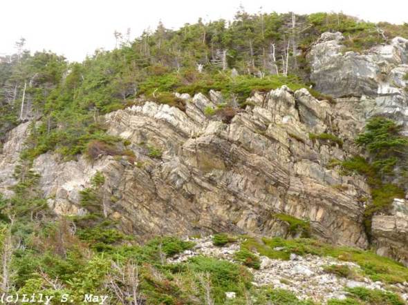
We hiked for around two hours, seeing vast views of the coast with cliffs and rugged rocky outcrops, some encrusted with lichens of different colours. A terrific way to end our trip.


Recent Comments